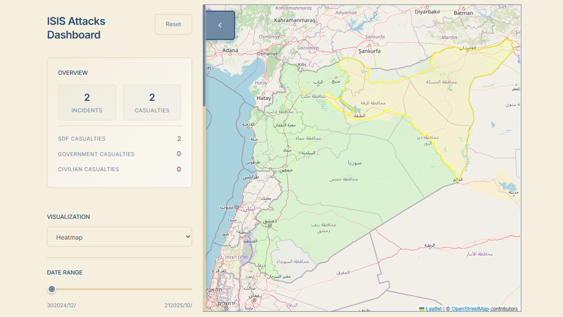
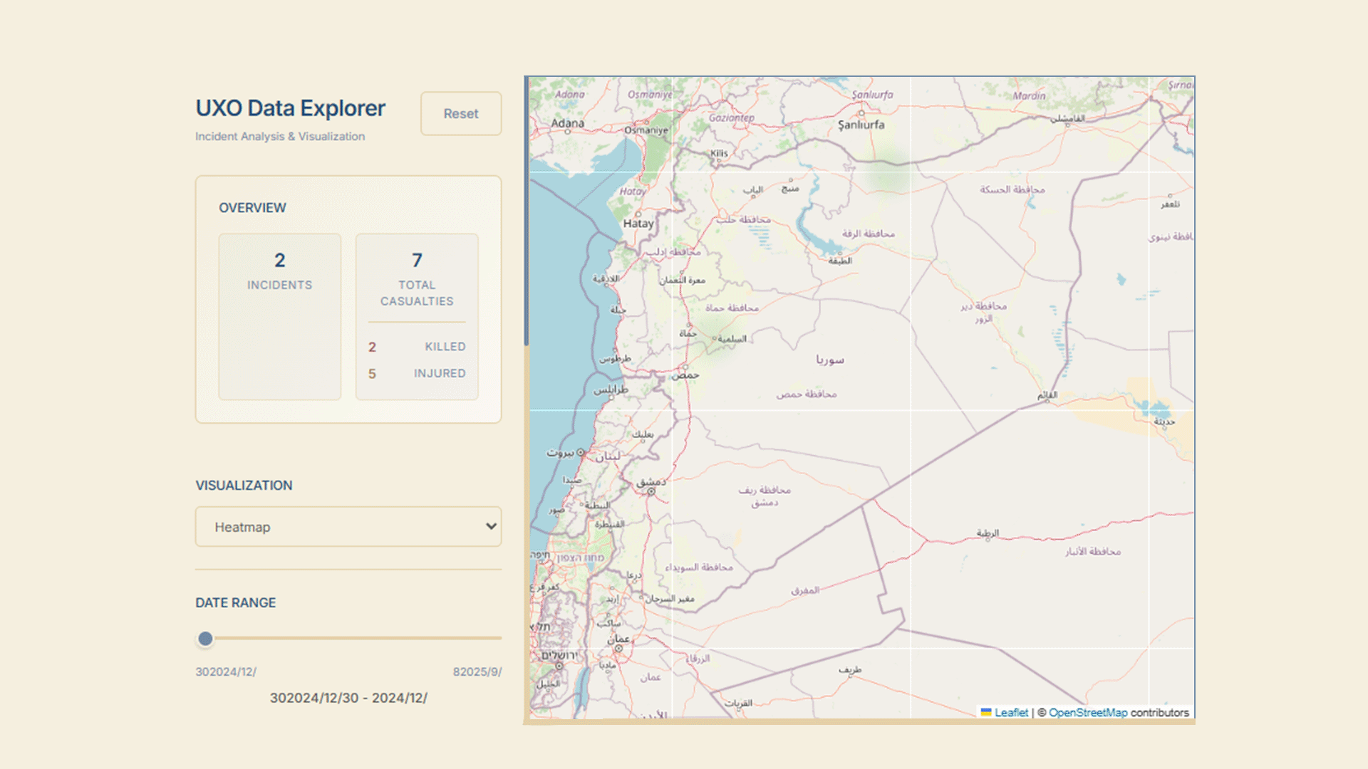
The tools provided in this section help Syria analysts navigate large datasets and access reliable information for their research on various economic and political topics using intuitive and interactive visualizations.
Interactive map tracking the Israeli incursion into southern Syria over time. Explore each incident on the timeline, see its location and date, and review linked headlines and news sources.
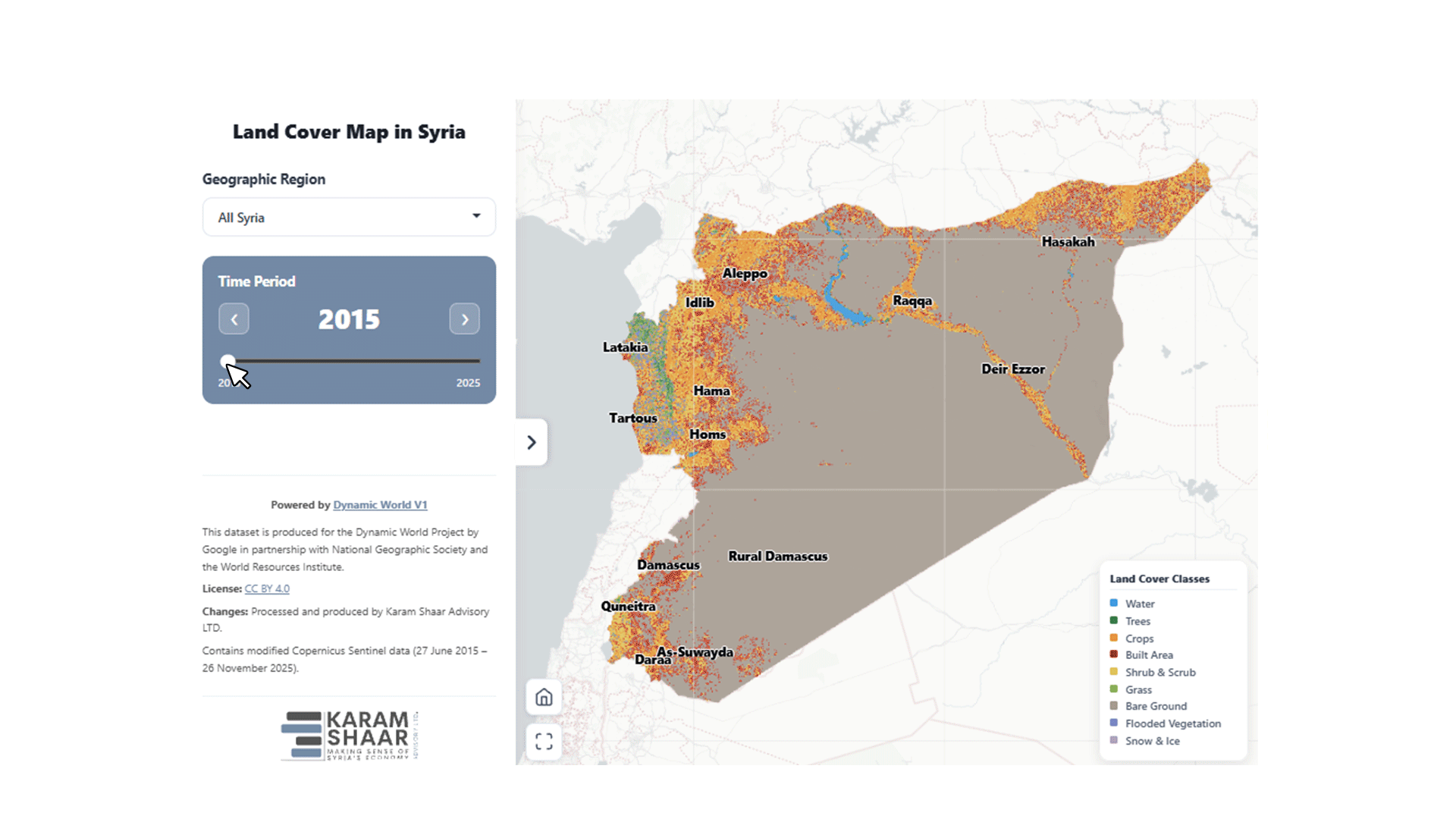
Interactive map visualizing land-cover changes across Syria from 2015–2025, including crops, trees, built-up areas, water bodies, shrublands, and barren land, with the ability to explore trends by governorate and over time.
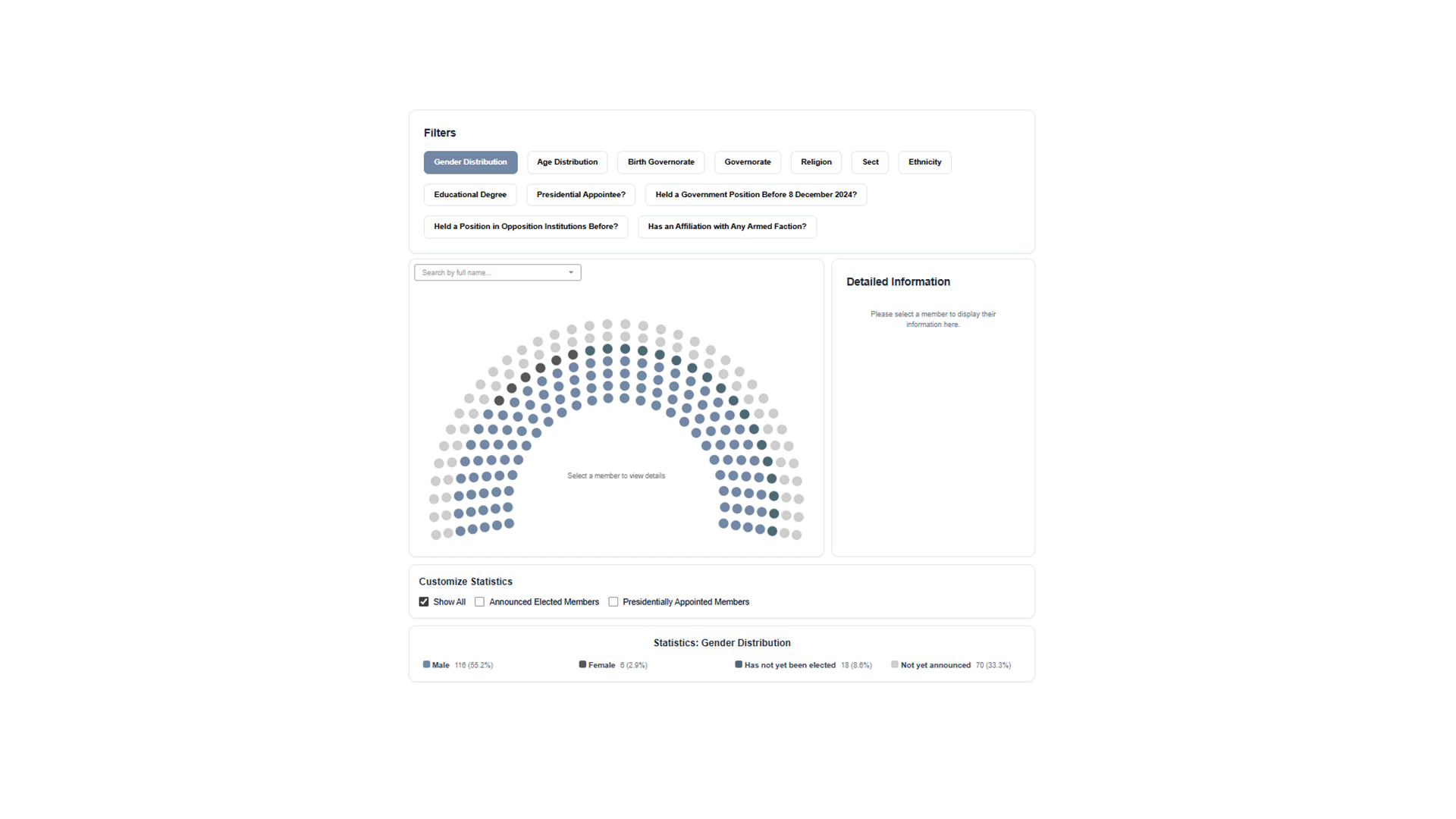
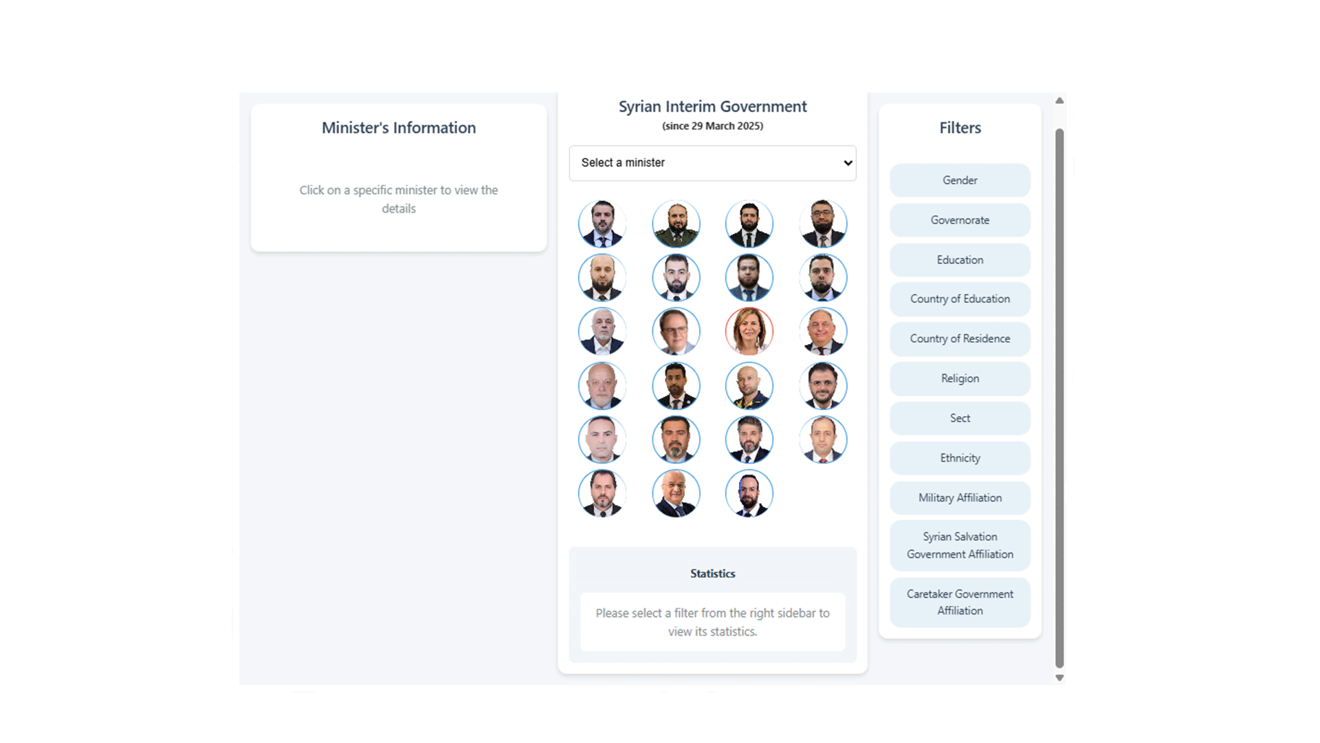
A filterable interactive visualization by Karam Shaar Advisory that maps every member of Syria’s 2025 People’s Assembly by gender, age, governorate, education, religion, and prior roles.